Díjszabás További vásárlásra lehet szükség

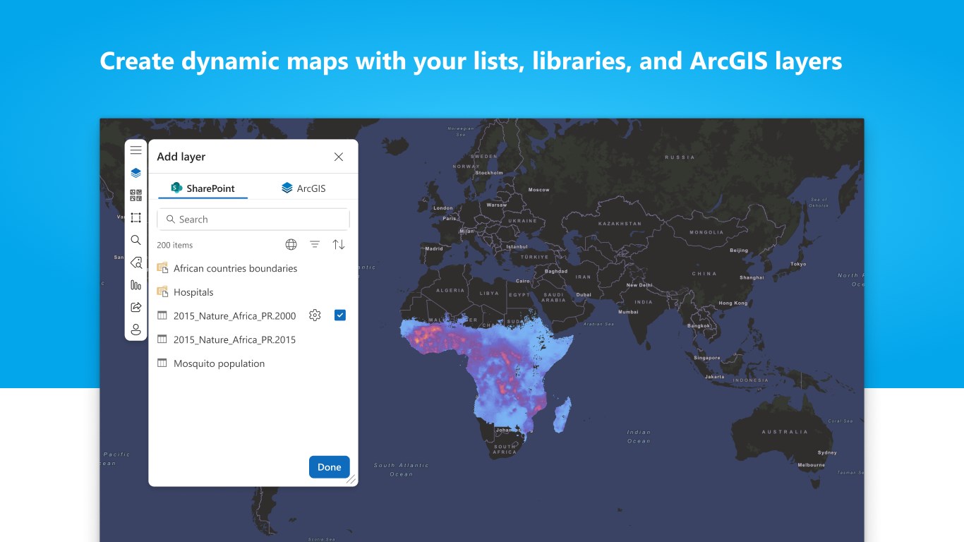
ArcGIS for SharePoint gives you a new way to map and search SharePoint documents and lists.
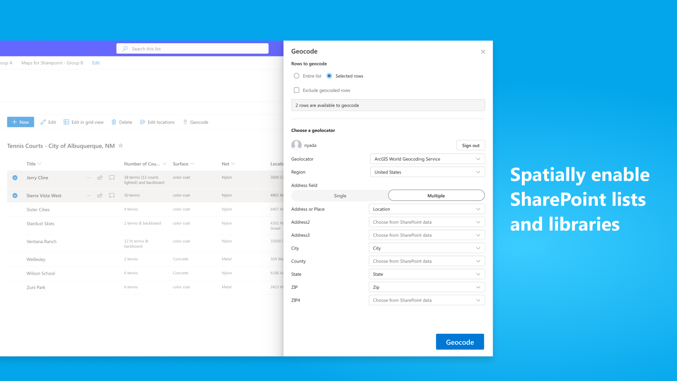
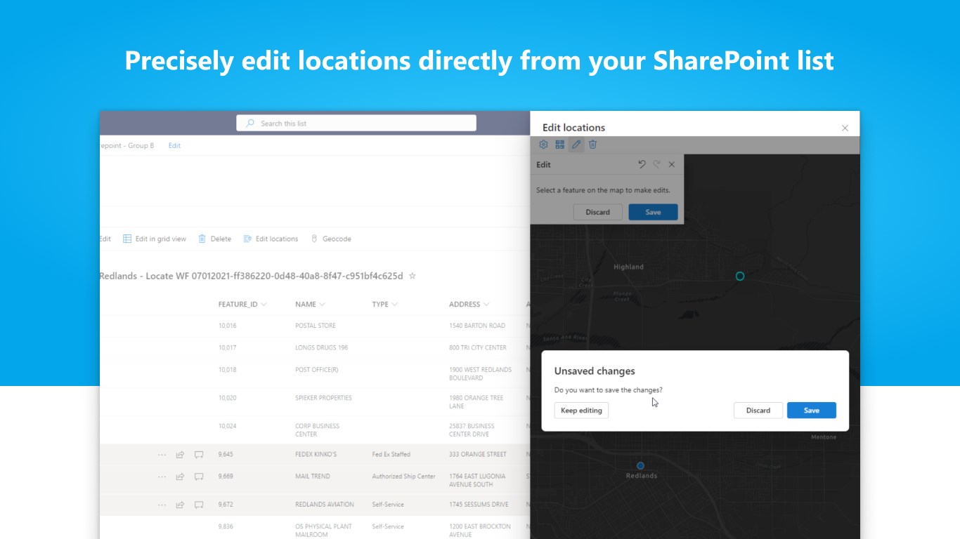
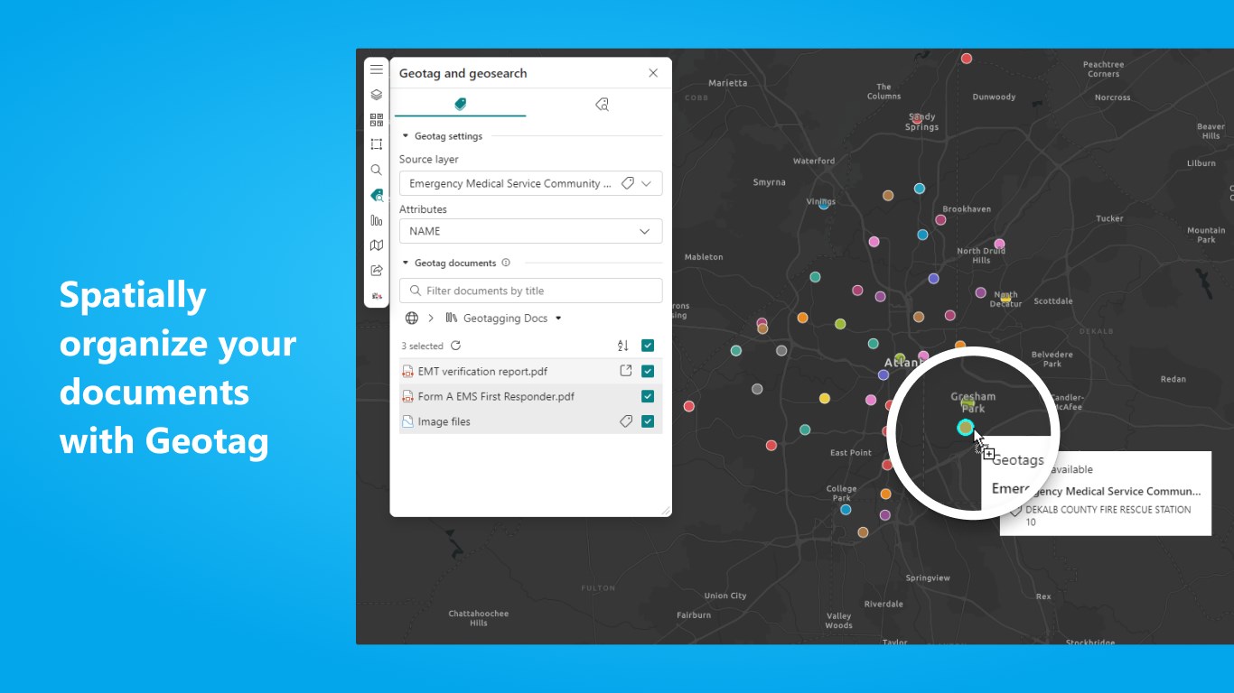
Visualize, organize, and interact with your SharePoint business data using maps for better insights and decision making. Combine your data with geographic content from ArcGIS and share the maps you create.
What's new:
Visit the ArcGIS for SharePoint Esri Community page for the latest change logs, product information, and the user forum.
This app is available in Arabic, Bosnian, Bulgarian, Catalan, Croatian, Czech, Danish, Dutch, English, Estonian, Finnish, French, German, Greek, Hebrew, Hungarian, Indonesian, Italian, Japanese, Korean, Latvian, Lithuanian, Norwegian, Polish, Portuguese (Brazil), Portuguese (Portugal), Romanian, Russian, Serbian, Simplified Chinese, Slovak, Slovenian, Spanish, Swedish, Thai, Traditional Chinese (Taiwan), Traditional Chinese (Hong Kong), Turkish, Ukrainian, and Vietnamese.
As a guest user, you can use ArcGIS for SharePoint without signing in to ArcGIS, or you can sign in to connect with your ArcGIS organization and access premium content, services, and analysis tools. Sign up for a free trial at esri.com.
Áttekintés
További alkalmazások innen: Esri, Inc.
ArcGIS for ExcelEsri, Inc. ExcelDiscover new patterns and bring Excel data to life with maps using ArcGIS.
Applicable to:Excel
NaN out of 2
ArcGIS for TeamsEsri, Inc. Office app
 Outlook
 TeamsArcGIS for Microsoft Teams enables you to discover maps and applications from around the world.
csomaglehetőségek megtekintése
Applicable to:Office appOutlookTeams
NaN out of 2
By getting this product, I give Microsoft permission to use or share my account information so that the provider can contact me regarding this product and related products. I agree to the provider's használati feltételek and adatvédelmi szabályzat and understand that the rights to use this product do not come from Microsoft, unless Microsoft is the provider. Use of feltételek is governed by separate adatvédelmi szabályzatuk and {4}.